Select NOAA-NWS Forecast Office Text Products
(Product availability varies with seasons, forecast office, and weather.)
Forecast Discussion for ,
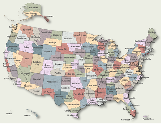
To Select Another NWS Office Click on Map or Choose from List
|
| Select Forecast Office: | Select Product: |
838
FXUS66 KLOX 272103
AFDLOX

Area Forecast Discussion
National Weather Service Los Angeles/Oxnard CA
203 PM PDT Mon Jul 27 2026

.SYNOPSIS...27/144 PM.

Hotter than normal conditions will continue for the foreseeable
future. Slight cooling is possible through Thursday, with heat
increasing again Friday through Sunday. The hot and humid
conditions during the day and night will bring elevated risks of
heat-related illness.

&&

.SHORT TERM (TDY-THU)...27/144 PM.

Widespread MODERATE TO HIGH heat risk is very likely to return
Friday into the weekend. Now is the time to start socializing this
threat with your community and family and consider rescheduling
activities that might but you or your loved ones at risk. Have a
plan to stay cool, especially if work or other activities take you
outside mid morning to mid evening hours or do not have access to
air conditioning. See extended discussion below for weather
details.

A large south swell from Major Hurricane Genevieve will further
enhance large wave and potentially deadly rip currents for some
area beaches. See Beaches discussion below and associated coastal
hazard products for details.

In the meantime, pretty dull (but warm) weather on tap for the
short term. The upper level pattern will not change much over the
next 72 hours with a powerful 597 dam upper high centered over the
TX and OK panhandles. At the sfc there will be mdt-stg (strongest
in the late afternoon) onshore flow to the east. The N/S gradient
will vary from weak offshore in the morning to weak onshore in
the afternoon.

The morning low cloud pattern will not change much at all. The low
clouds will be likely across the LA csts and the western SBA cst.
There will also be a 30-40 percent chc of low clouds reaching the
VTA csts as well as the SLO cst.

There will be another round of gusty Sundowner winds across
southwest Santa Barbara County the winds look a little weaker than
last evenings and will likely come in just under advisory levels.

Today will be the last day of the current heat advisory as the
combination of 95 to 101 degree temperatures and higher than
normal humidity will continue the hazardous heat levels. There
will be a a degree or two of cooling for most areas Tuesday and
Wednesday as hgts fall a little. More importantly drier air will
sweep in from the NW (PWATs fall from around 1 inch to near 0.70)
and this will make the lower temps feel even better. That said
the higher than normal sea sfc temps will keep humidities a little
above normal especially near the coast.

On Thursday the upper high begins to migrate back to the west,
initiating widespread warming with a moderate 60 percent chance of
reaching advisory levels for interior areas by Thursday. More
widespread and significant warming will continue into the weekend.

.LONG TERM (FRI-MON)...27/143 PM.

Widespread MODERATE TO HIGH heat risk is very likely to return
Friday into the weekend. Now is the time to start socializing this
threat with your community and family and consider rescheduling
activities that might but you or your loved ones at risk. Have a
plan to stay cool, especially if work or other activities take you
outside mid-morning to mid-evening hours or do not have access to
air conditioning.

RECORD BREAKING or tying (for at least July since 1999) 500 mb
heights of 598-600 dm is likely sometime Friday into Saturday with
only modest weakening into early next week. A Heat Watch will
eventually be needed to cover this very concerning period
(especially Friday through Sunday) Widespread highs of 95-105
away from the coast with pockets of 105-115 in warmest coastal
valleys to interior are likely during the peak of the heatwave
Friday and Saturday. Highs 80-95 will be common coastal areas away
from the beaches. Overnight lows in the 70s and 80s for many
areas will increase risk for heat stress through prolonged
exposure and limited ability for dwellings without air
conditioning to cool overnight.

There is also an increased risk for large and dangerous fires due
to the hot and unstable conditions with pockets of gusty winds,
perhaps, especially southwest Santa Barbara County and the I-5
corridor in the mountains into the weekend.

Night to morning low clouds will diminish or disappear during
this time, although weakened onshore focused to the east will
somewhat limit the heat nearest the coast. However, well above
normal water temperatures will somewhat maintain the humid muggy
feeling near the coast, decreasing the body`s ability to cool
through sweating.

&&

.AVIATION...27/1726Z.

At 1630Z at KLAX, the marine layer was 1400 ft deep. The top of
the inversion was near 4700 ft with a temperature of 24 Celsius.

High confidence in TAFs for KBUR KVNY KPMD KWJF and KPRB.

Moderate confidence in TAFs for KLGB, KLAX KSBP and KSMX where
the arrival and departure times of CIGs could be off by +/- 2
hours. Min CIG heights may be off by +/- 200 feet, with a 20%
chance for VLIFR conds at KSMX/KSBP.

Fair confidence in TAFs for KSBA and KCMA with only a 15 percent
chc of IFR cigs 13Z-17Z.

Moderate confidence in TAFs for KOXR and KSMO with a 30 percent
chc of IFR/LIFR cig/vis 12Z-17Z.

KLAX...Moderate confidence in TAF. Cigs could arrive as early as
07Z and as late as 12Z with transition to VFR sometimes 28/15Z-18Z.
High confidence in any east winds staying under 8 knots.

KBUR...High confidence in CAVU TAF.

&&

.MARINE...27/202 PM.

Good confidence in a prolonged period of gusty northwest winds
across the coastal waters through this week, except for nearshore
south of Point Concpetion (including eastern Santa Barbara
Channel and the waters adjacent to the Los Angeles and Orange
County coasts). Small Craft Advisory (SCA) conditions will
fairly persistent, with periods of marginal Gale Force Winds near
35 knots this afternoon and evening, and potentially again
tomorrow afternoon and evening.

Nearshore south of Point Conception, marginal SCA level winds
(20-25 knots) will become common across the western half of the
Santa Barbara Channel each afternoon and evening with low chances
of extending into eastern portions of the Channel. However, today
is an exception where marginal SCA level winds are forecast across
the eastern half of the Channel through this evening. The
southern nearshore waters are expected to see winds remain below
20 knots.

Seas are expected to hover near 8-10 feet across the waters away
from the coasts much of the week. A southerly swell from Hurricane
Genevieve will send a modest southerly swell into the waters
tonight into tomorrow, which will continue into the weekend. This
south swell may impact south facing harbors, including Port San
Luis.

&&

.BEACHES...27/202 PM.

An extended period of a combination of moderate to long period
southerly swells will continue through this week and into next
weekend. A long 17-20 second period SSW Southern Hemisphere swell
will continue to impact our area through mid week. Then Category
5 Hurricane Genevieve will send another southerly swell to SoCal
Tuesday.

A Beach Hazards Statement is in effect through Wednesday (except
through Saturday along the Central Coast) due to the increased
risk of dangerous rip currents and elevated surf. There have been
numerous ocean rescues reported.

A High Surf Advisory has been issued for Wednesday evening through
Saturday evening for the incoming southerly swell due to Hurricane
Genevieve, particularly for south facing beaches exposed to
southerly swell (such as from Manhattan Beach to Port Hueneme
along the Malibu Coast, and from Long Beach to the Palos Verdes
Peninsula). This swell will peak around 3-5 feet at 12-15
seconds from 160-180 degrees.

Additionally, a Coastal Flood Advisory has been issued for
Wednesday evening through Friday evening for the Ventura and Los
Angeles County Coasts. High tides of 6.2-7.0 feet will peak in the
evening hours. In conjunction with the highest expected surf from
the Hurricane Genevieve southerly swell, the best potential for
minor coastal flooding impacts is expected Wednesday and Thursday
evening. Generally minor impacts are expected, such as pooling of
seawater over low lying coastal areas in susceptible areas.

&&

.LOX WATCHES/WARNINGS/ADVISORIES...
CA...Heat Advisory remains in effect until 8 PM PDT this evening
      for zones 38-88-342>345-348>358-362-366>382-548. (See LAXNPWLOX).
     Beach Hazards Statement in effect through Saturday afternoon
      for zones 340-346. (See LAXCFWLOX).
     Beach Hazards Statement in effect through Wednesday afternoon
      for zones 354-362-366. (See LAXCFWLOX).
     Coastal Flood Advisory in effect from 5 PM Wednesday to 3 AM
      PDT Saturday for zones 354-362-366. (See LAXCFWLOX).
     High Surf Advisory in effect from 5 PM Wednesday to 5 PM PDT
      Saturday for zones 354-362-366. (See LAXCFWLOX).
     Extreme Heat Warning in effect until 8 PM PDT this evening
      for zone 383. (See LAXNPWLOX).
PZ...Small Craft Advisory in effect until 3 AM PDT Tuesday for
      zone 645. (See LAXMWWLOX).
     Small Craft Advisory in effect until 9 PM PDT this evening
      for zone 650. (See LAXMWWLOX).
     Small Craft Advisory in effect until 3 PM PDT this afternoon
      for zones 670-673-676. (See LAXMWWLOX).
     Gale Warning in effect until 3 AM PDT Tuesday for zones
      670-673-676. (See LAXMWWLOX).

&&

$$

PUBLIC...Munroe/Rorke
AVIATION...Lewis
MARINE...Lewis
BEACHES...Lewis
SYNOPSIS...MW/RK/CC

weather.gov/losangeles

Experimental Graphical Hazardous Weather Outlook at:
https://www.weather.gov/erh/ghwo?wfo=lox
|
Previous Forecast Discussions may be found at
NWS , (LOX) Office Forecast Discussions.
(Click 'Previous Version' there to view past versions successively.
Some may differ only in time posted.)
Products Courtesy of NOAA-NWS
NWS Information Parsing Script by Ken True at Saratoga Weather - WFO and Products Scripts by SE Lincoln Weather.
Mapping by Curly at Michiana Weather and by Tom at My Mishawaka Weather.